Owl’s Head (Scraggly Lake)

Viewpoint on Owl’s Head.

At 964 ft, Owl’s Head (Scraggly Lake Public Lands) feels farther from nearby Baxter than it is. It is a lollipop hike. The 1.3 mile flat stick hangs to the shoreline until it splits into a .6 loop rising up, over, and around the high point. Even more intriguing, it is a suggested easy hike in the Maine Mountain Guide.

I did not plan to detour to Scraggly Lake after Horse Mountain. I did not know the road conditions. Having inquired about other roads the day before, I did not feel optimistic that my Honda Fit could make it 9.3 miles up the Scraggly Lake Road from the Grand Lake Road (the road to Baxter’s north gate). Yet filled with glee after bagging the Billfish Gorge spur, I followed a reckless “might-as-well-try” instinct.

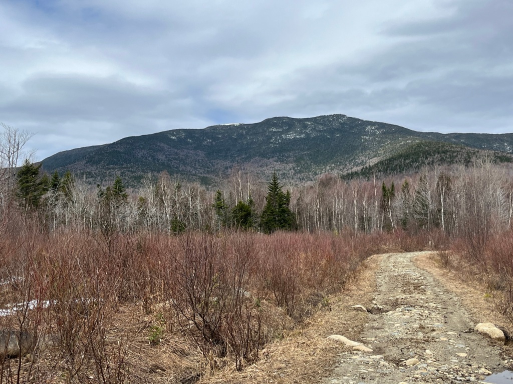
The Scraggly Lake Road starts well-graded. A sign eventually announces the start of the unmaintained road. Even then, my Honda Fit powered through water spilling onto the road and around protruding sticks and rocks. At one spot (in the maintained section I think), the road is washed away above a small part of a culvert and marked with a flag. Small potatoes to this Maine native, but maybe nerve-wracking to someone else.

No sooner did I pull into the grassy parking area for Owl’s Head did a public lands employee drive by in a truck. He warned me no one had tackled the blowdowns on the trail yet. No worries.

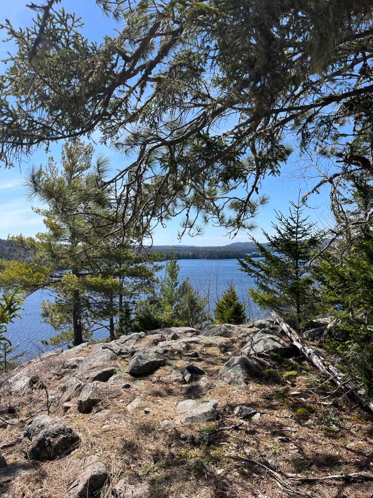
The lollipop stick hugged the lakeshore so tightly that a strong wind followed me as I hiked. I loved it. My eyes tired of solid white, I soaked in the green eye candy of cedar and moss and ferns. It reminded me of the most beautiful Downeast forests, dropped in the northern Maine woods.

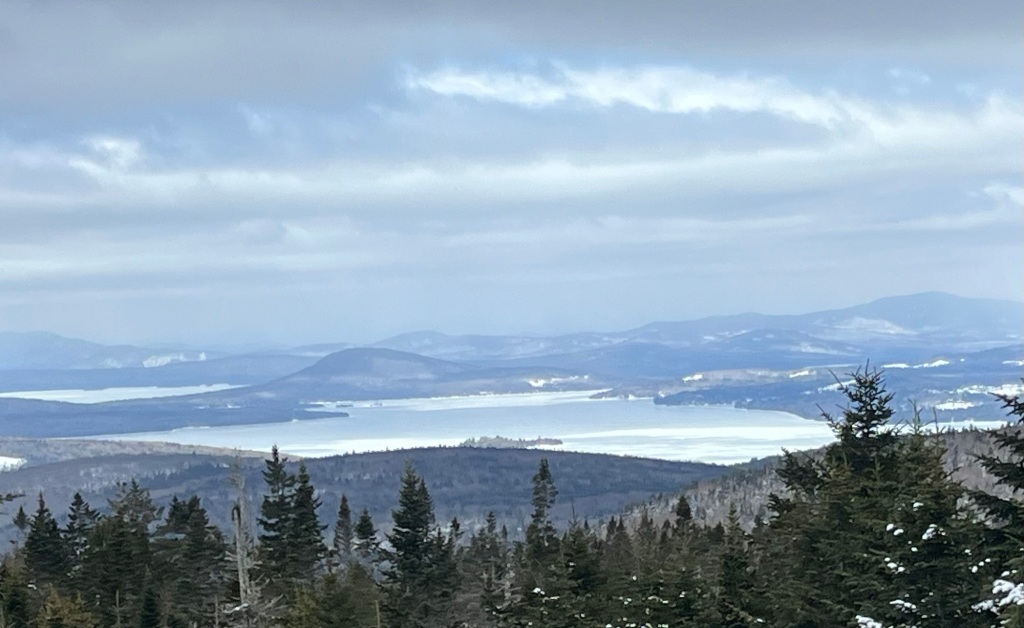
Several viewpoints greeted me with benches and chances to spot the boat launch across the lake and the crown I was about to climb. The shore seemed to keep pulling me towards it, knowing that I would rather be on the water. The final tease? Right before ascending to the loop junction, a side trail leads to the water for boat access.

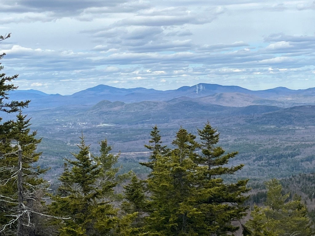
I turned right at the loop junction. 240 ft of vertical gain from the loop junction to the summit, minuscule compared to a Baxter hike but enough rise to catch a view. The first viewpoint turned out to be my favorite: the high peaks of Baxter still snug under a blanket of snow while I surrounded myself with the warmth and green of spring.

Blowdowns are persistent but not unbearable. Descending from Owl’s Head, I hit the worst: a blowdown so large that it had taken down others with it and obscured the trail. It had been there long enough that a well-established herd path circumvented it.

Nothing could spoil the hike. New spot, gorgeous day, suspenseful drive to the trailhead….what more could I want?

Lower Berry Picker’s (Saddleback)

View of Saddleback from Berry Picker’s

The charm and challenge of the scenic Berry Picker’s trail (Saddleback) is that it is not easy to reach the upper or the lower trailhead. To reach the upper, located on the AT in the col between Saddleback and the Horn, hikers must trek up either the AT or the ski slopes. To reach the lower, off Potato Hill Road, one can either drive to the closed bridge (unsafe for vehicles, unclear if safe for pedestrians) and road-walk 3 miles or utilize the Fly Rod Crosby trail.

I had incorporated the upper 1.5 miles of Berry Picker’s into loops on two separate occasions: once with the AT, once with the ski slopes. Both times, I hopped on the Fly Rod Crosby trail to return to my origin point. Highly recommend both loops. I had never considered starting at the Potato Hill Rd trailhead, because I had heard the roads were rough and hard-to-follow.

As I approach finishing the Western Lakes and Mountains section of the Maine Mountain Guide, I knew I needed the lower part of Berry Picker’s. I wanted it soon. It is a low-elevation trail. I am cleaning up accessible low-elevation trails while I wait for roads to solidify and rotten snow to melt.

After calculating mileage and guesstimating conditions, I chose the Fly Rod Crosby approach, a 12.6 mile route roundtrip. Started at the Rock Pond trailhead 2600 feet. Still seemed like two feet of snow under the softening packed trail (snowshoes recommended but you will still break through to water).

Easier going on the snowmobile trails, no need for snowshoes or traction there. The snowpack does begin to fragment until south of the AT crossing. I found I preferred walking on the patches of snow rather than sinking into the mud.

The thrill of the day? Cresting a steep hill, pulling out my camera, only to find a moose 1/4 mile down the trail dumbfounded to see a hiker. “It’s April, what are you doing here?” he seemed to say before taking off.

I had not rushed to complete the southernmost mile of Berry Picker’s because I heard it was unspectacular. Now it may be unspectacular compared to magic of the upper section. For an ATV trail, this one mile stretch has mountain views ascending and descending. I crossed 4-5 wet, soft spots on this mile stretch that an out-of-stater might suggest need culverts. You have been warned.

Important note if using the Maine Mountain Guide: the ATV gate is no more. It has been dismembered and pieces visible on the side of the trail. No “Berry Picker’s” signage exists at the trailhead. The signage says “ITS 89”, “ITS 84”, and “Coos Canyon 53 miles”. No formal parking but cell service. It feels like the Wild Wild West of Western Maine, remote and rough and fun for that reason.

Speckled Mountain Pasture Trail

Map of Bald and Speckled (Peru)

Now that I have completed the lower part of the Speckled Mountain Pasture trail (Peru), I plan to call it Speckled’s Vestigial Tail, due to not being hiker-friendly and its subsequent lack of use. As attached as the AMC may be to this “legacy” trail, I strongly recommend NOT using the Dickvale Road trailhead.

The problem is not the 1.9 mile route on uninspiring ATV trails. It is the trailhead-no-one-would-ever-know-was-a-trailhead on Dickvale Road. It is located where the pavement turns to dirt, at “The Searles Orchard Road” gate. The Maine Mountajn Guide instructs roadside parking. It is not the widest road and provides little shoulder. Adding to the awkwardness, that gate is located opposite a residence. A better parking situation is .4 downhill (north) on a wide shoulder next to the stream.

Rather than describe the neighborhood, anyone interested can go on Google Earth and look at the intersection of Dickvale and Mary Turner to sense the vibe. Alone, I feared for my safety more than any other trailhead in Maine (experimented with Facebook Live for the first time and that coaxed me through the discomfort).

Thankfully, this trailhead is not the only portal to the highly-worthwhile, lesser-travelled side of the Speckled Ridge. Starting at Concord Pond, hikers can either venture .9 past the Speckled summit and turn around, or, if adventurous, brave the informal loop. The AMC book could axe the Dickvale Road trailhead and Pasture trail heading, and assimilate the extraordinary .9 ridge walk as a mentioned distance from the summit in the Speckled description.

I doubt the AMC will sever Speckled’s Vestigial Tail, but do not take that as the green light that all is well. The book comes with a “use your best judgement” disclaimer. Unless a hiker is trying to complete every trail in the book, no reason to go to Dickvale Road, trust me.

Speckled Mountain Pasture Loop (Peru)

Mt Blue, Bull Rock, and Saddleback Wind as seen from Speckled Mountain.

When hikers summit Speckled (Peru) from Concord Pond, they may notice that the trail continues along the ridge. It follows the ridge for .8 before swinging north to a logging road. This road can be used to loop back to the pond, but hikers must be comfortable navigating an overgrown former ATV trail between the road and the pond. Alternatively, this lesser-travelled section of ridge, a small stretch of the logging road, and a different ATV trail combine to form the Speckled Mountain Pasture trail. The Pasture trail is a Maine Mountain Guide (MMG)“legacy” trail starting on Dickvale Rd.

Already a fan of the Concord Pond route, I wanted to experience both versions of the Pasture trail. Yesterday Neil and I hiked the loop. Later this week, I intend to hike from Dickvale Rd.

I had wanted to climb Speckled with Neil, of @westernmaineviews, ever since I messaged him about the Pasture trail. He sent me a map showing 4 ways to access the Pasture trail. The Pasture trail expert, sign me up.

After we parked on Redding Road, we found trouble on the 1/2 mile access trail to Concord Pond. Now that more ice has melted, the beaver pond flooding the trail should be more obvious and easier to avoid. I had no idea of the water depth when the sheet of ice split and I sunk up to my knees. Sure sign that the hike would be an adventure.

A synopsis of conditions for the 8.5 mile hike? Snow drifts and wet bare ground. The pond trail is easy enough to follow. The overgrown ATV trail connecting a pond-side campsite to the logging road is not. Track required, preferably with someone who has hiked it before.

When we burst onto the logging road, I felt relieved. On the 1.5 mile walk to the official Pasture trail, we admired Zircon and Tumbledown and the Jacksons. The yellow boundary blazes are the dead give-away to turn off the logging road and start heading up to the ridge. The trail gains 400 ft in a half-mile as it parallels a heavily-harvested clearing. The trail is well-defined, due to dirt bike activity.

Sooner than expected, we reached the ridge and hit view after view. Nothing I love more than a ridge walk, even if I have to hike through calf-deep snowdrifts. I spotted red spray paint and cairns marking the way. I also noticed recent chainsaw work; seems like the dirt bikers keep this side of Speckled more clear than anyone does on the Concord Pond side.

Cannot wait to see Neil’s shots of the hike. I do not need a photograph to remember The Shute on Speckled. It was a surprise when I hiked Speckled during foliage season 2020. This time, it was slippery but not entirely snow-covered. I had to settle for butt-sliding on the bare rock, during which I lost control and bent a pole. Better to bend a pole than break a leg (Neil slipped on microspikes at this point; I played the stubborn hiker card and did not).

For me, this loop is an epic Western Maine route. So much to love on Speckled, and the Pasture trail opens it up even more.

Bald (Mt Chase)

Waterfall trail at Mt Chase

Last week, I talked to a couple hikers about the gorgeous vantage point at Mt Chase, perfection if they did not mind the two mile snowy road walk to the trailhead. It left me wanting to revisit the area. I had hiked to the Mt Chase summit and Eagle Rock spur last August. I still wanted to summit the adjacent Bald Mountain.

The Bald Mountain trail veers east off the Waterfall trail, Waterfall a scenic alternative to the main trail. I first heard of Mt Chase Bald when a hiker injured herself there in 2021. When the AMC released the second edition of the 100 Mile Wilderness map, I noticed the addition of the Bald Mountain trail. I suspected it would be added to the 12th edition of the Maine Mountain Guide.

I could have waited for directions from the 12th edition. My insatiable curiosity prompted me to attempt it in August. I followed sporadic pink and orange flagging tape along a contour, across a stream, and up an old woods road to a young beech stand. The route appeared flagged well-enough until .2 before the summit. I turned around there due to uncertainty.

I had hoped for better results today with the 12th edition description in hand and a self-made track based on public tracks. Parked at the winter space tucked inside Mountain Road from Rt 11. Barebooted on the compacted snow two miles to the trailhead.

Straight ahead, 100 eclipse viewers had compacted the main trail down to a tread way of consolidated snow. To the right, north of the picnic table, a few boot tracks headed towards my favorite ascent route, the Waterfall trail (caution: stream crossings and streamside route may not be appropriate for all or all seasons).

The million dollar question: did any eclipse viewers break out the Bald Mountain trail? Heck no. When I reached the Bald Mountain turn-off, I saw an adventure of unbroken snow. The snowshoes I carried soon became bound to my feet as I followed the now familiar route.

I soon arrived back in the young beech forest at the infamous last piece of flagging tape. I searched the leafless woods for pink or orange or any color tape. No luck. The path remained wide and clear in the direction of the summit cone, so I proceeded to the base.

Until this point, the MMG description can be followed even in winter conditions. It now instructed me to look for a mossy outcropping. It seemed like there were numerous, all covered in snow! Even worse, a cairn in a small opening! Funny thing about trying to find small cairns in snow-covered woods…challenging for sure.

Realizing the silliness, a sensible guidebook hiker may have turned around there. Not me. Was there a path to my left? Nope, that goose chase landed me to the north of an outcropping wall too steep to scramble up.

I retreated back to the last known piece of flagging tape and looked at the mossy outcropping contenders again. I spotted rocks that looked like I could “weave through”, as the description said. I headed there.

It felt path-like leading to the south side of an outcropping wall. Where would I scramble up? I could see a thick coating of ice exposed under the snow. I thought of the 2021 search and rescue. I pushed my way through dense branches in search of a hint of a trail.

411 feet from the summit, Gaia said. It was somewhere up on the ledges. If I wanted to tag another Bald, I could have pushed my way there. Yet that is not the game. This is the follow-the-blazes/flagging tape/cairn/directions-in-the-MMG game. Like it or not, I will have to come back in May to hike it to my satisfaction.

Jackman

Totality over Sally Mountain

I did not plan on experiencing totality at the Big Wood Pond boat launch (Jackman). I had never seen the boat launch, nor did I know that mountains surround the pond.

I had spent months daydreaming about possible hikes (Mt Chase? Saddleback? Sally?) until a week before the event. My five year old knew about the path of totality. The eclipse could not be experienced without him. However, he could not handle a long hike in April.

I started panic-texting friends in Greenville. Would anyone have room for us? By some miracle, a friend left her camp on Moosehead heated and driveway plowed. It was ours for the taking.

I told myself we would watch from the camp. Yet I woke up in my “more mountains, less jerks”sweatshirt on eclipse morning. I wanted to be in Jackman, the Switzerland of Maine. I had fallen for the mountains and woods and waters of Jackman in the last two years. I needed to be there.

On our way to Jackman, I noticed more folks camping on 15 than I had ever seen, even in summer. Still plenty of parking on Main Street when we arrived at 730am. The destination on my mind? Attean Pond.

We headed down Attean Road, a paved road that turns to relatively well-graded dirt. This time of year, Attean Road is gated a mile before the boat launch. Hikers park here to access Sally Mountain via the railroad bridge. At 8, 10 or so cars were parked.

We walked the snow-covered mile to the boat launch. Once at the launch, I realized I had goofed. Though the temps were in the upper forties and climbing, the ground remained snow-covered. I brought nothing to sit on. The view from Attean Pond does not become dramatic until you paddle further out. Did not seem like the best viewing location.

Once back at the car, the number of parked vehicles had doubled. We headed to Main Street. We parked the Raav as close to the junction of 15 and 201 in hopes of dodging afternoon traffic. The viewing area next to the town office did not thrill me. Although a Boundary Bald fan, I wanted to face a mountain in the southwest.

The town now a zoo, we opted for late morning pizza at Bishop’s. Bishop’s pizza is legendary for those of us who recreate in Jackman. As a hiker, I think of Bishop’s to give me an extra push at the end of the day. I had not been since deer hunting season.

The eclipse crowd could not be more different than the deer hunters. No Mainers, all out-of-staters bundled up in down jackets in now fifty degree temps. I pulled a Mainer move and purchased a tarp to sit on.

Once done eating, we did not know where to go with this tarp. I saw a boat launch sign off Main Street. I decided to check it out.

Fifty folks already lined the edge of Big Wood Pond. When I saw the view, I did not care: Sally to the southwest, the scenario of my wildest dreams. Other mountains framed the pond to the west and north. I had found Switzerland!

We found a large flat rock…and waited…and waited..and waited. The moon crept so slow that it was never going to happen. It was never going to bust a move.

Then came…The Move. A professor announced to his class that we could see totality coming from the west. As the darkness swept over us, sunset glowed above the mountain ridges. The most beautiful moment of day, teasing us at 330 in the afternoon.

My son began howling like a wolf. Someone in town set off a couple fireworks. I gazed at the corona over my beloved Sally, and I burst into tears.

I have paddled to Sally. I have picked blueberries up there and jumped in the pond afterwards. I have crossed the railroad bridge and completed the glorious loop across the ridge. I already considered it to be a not-to-be-missed Maine woods experience. Now I feel more connected than ever.

Wheeler Brook

Faded blaze on Wheeler Brook trail (Evans Notch)

Whenever I flail around looking for anyone to hike in Evans Notch with me, only the most adventurous respond. For the Wheeler Brook trail (Gilead), the only taker? Sam, whose trip reports I have read and utilized for years. I could not be more thrilled. I knew with Sam, not only would we hit every blaze, we would check out the waterfalls off-trail.

We planned to leave one car at the 113 gate and one at the wide shoulder at Rt 2. At 730am, we started snowshoeing south from Rt 2. “Ideal snowshoeing conditions”, the snow still crunchy on top so we hardly sank. The trail starts on a gated logging road, blazed yellow for its entire length (but many blazes faded or blending into the bark).

Sure enough, half mile from the northern trailhead on Rt 2, Sam led me to the waterfall and flume 15 or 20 feet off-trail. As Sam says, for folks who do not want to do the full trail, the unmarked waterfalls are a worthwhile attraction.

When hiking Wheeler Brook southbound, hikers hit 4 stream crossings in the first 1.5 miles or so, and numerous water bars and rivulets on top of that. Water levels are low at the moment and snow bridges have melted. Rockhopping in snowshoes it was!

At every stream and water bar dip, we found ourselves hoisting our bodies up steep snowy banks. A natural athlete, Sam handled this with ease. Me? A terrified baby otter, a new level of desperation knowing I must pass every test.

This trail does not cross the summit of Peabody. It still gains 1350ft in 2.1 miles and crests on the viewless shoulder of Peabody. The advantage of tackling this in the leafless woods is that descending southbound, I caught satisfying glimpses of the Royces and Wild River Valley.

Descending Peabody southbound is also the trickiest spot to navigate. The blazes have not been repainted for some time once over the crest. Aided by a log, a bonus stream crossing awaits on this south side.

We stopped at the Little Larry Brook bridge and lunched before heading to the car on 113. Hard to believe the water rose so high that it wedged debris in the new Roost bridge. Sam noticed lots of repairs needed on 113 and expects it to open later rather than sooner.

I have struggled with Evans Notch and 2.5 hour drives to its empty trails. It is the Lost Kingdom of Western Maine, an adventure lover’s paradise. I can appreciate that element more when hiking with someone else.

Caribou Pond

I could have asked someone for a track for the 1/2 mile whack between the Sugarloaf Golf Course and Caribou Valley (Pond)Road, but what fun would that be? I decided to experiment with Gaia public tracks to decipher the popular winter peak bagging route.

Gaia showed I would cut into the woods across from the 11th hole. Once in the woods, the routes split all over the place. I drew a rough outline of a plausible route.

Because winter peakbagging season is over, I did not expect any old tracks and I saw none. I strapped on the snowshoes and followed what felt like a cleared path. Pink flagging on the left, red paint on a tree after that, and then blue flagging to my left and right where the cleared path ended.

Turning left and following that blue flagging tape parallel to the stream turned out to be the Golden ticket. Not the plausible route, a branch-whacker of a choice, but the consistent flagging delivered me to Caribou Valley Road.

Caribou Valley Road is still a snowmobile trail, though I saw no snowmobiles. Bareboots on this scenic road, all the way to Caribou Pond….

Fly Rod Crosby Trail

Overlook, Rock Pond Trail

In addition to capturing spur trails in the Rangeley-Stratton area, I need to resolve the conundrum that is the Fly Rod Crosby Trail. The Maine Mountain Guide (MMG) describes a 12.3 mile (underestimated) section between Saddleback and Reeds Mill Rd. It also mentions 19 miles of open trail (the strictest rules expect guidebook hikers to cover mentioned distances). The MMG excludes the Cascade Stream Gorge trailhead, featured on the map, and leaves out Reeds Loop.

Vagueness of the description aside, I have to decide how much of it to tackle and decide soon. It is a lower-elevation trail, so I would like to have it done by the end of April.

My gut instinct is blowing through it and hitting every blaze, including the Cascade Gorge and Phillips sections. The MMG description is sloppy, but I do not want to be. I hiked the section from Saddleback to Berrypickers in 2022. In the windiness of today, I decided to revisit the Rock Pond trail and explore its side trails.

Bareboots on the well-packed trail until south of Rock Pond, then snowshoes the rest of the day. Snowshoeing to the Overlook could be a fun casual Easter outing. I did leave some red herrings as I fumbled up the trail (only yellow blazes on the upper half, mapping app recommended for the lower half). Mission accomplished and heck of a view. I crossed one bridged and one unbridged stream, both tricky. I think water crossings could be the most challenging part of tackling it early in the season.

Yet I love adventuring in the 4 to 27 corridor. I never want to run out of new escapades in this corner of the state. The Fly Rod Crosby trail, rumored to be hard-to-follow in places, will be a chunk of the 2024 chapter.

Caribou Bog Conservation Area (Orono)

Skier survived Bangor Hill.

First time skiing at Caribou Bog Conservation Area (Orono) and finally found Bangor Hill! My mother has kept a Caribou Bog ski race hat for decades. I never made it here until last summer. I ended up lost in a downpour, trying to find Bangor Hill after climbing Newman Hill. More trails here than any map or app suggests. Gaia actually depicts two Bangor Hills. It felt like a miracle when I emerged out of the woods to the sight of Black Pond.

The place hooked me. I came back with my five year old in hopes of climbing Bangor Hill. Ice skaters deterred us. Nothing to see there, not a view of Katahdin like I read somewhere.

I did not arrive today with any hope of finding Bangor Hill. I wanted the miles of groomed trails, like the other skiers in the packed lot. I started with skiing the old railroad bed to Kirkland Road. If I only skied that, it would have been a spectacular day.

On the way back, I opted for the Heron Loop. At the end of the Heron Loop, it did not look that far to the elusive Bangor Hill. Nothing about the approach seemed steep. I focused on not making any wrong turns, and I made it! As the skaters said, the summit is wooded and recent thinned. No view of Katahdin (I searched), but a nice bench.

I did not consider that the most efficient descent trail may not be as gentle as the ascent trail. I have been skiing since I was 3 or 4, but my snowplow is rusty. My knees are still strong. They saved me from death, I am sure of it. I found it thrilling to reach the bottom still on my skis and not in a snow bank.

For the third time, I left Caribou Bog with a new story to relish. I love that Orono has this sprawling wild space for adventures. Cannot wait to see more!